In this second part of a three part series on the cultural and natural secrets of the ACT's electorates, today Tim the Yowie Man shines the spotlight on Kurrajong and Brindabella.
Subscribe now for unlimited access.
$0/
(min cost $0)
or signup to continue reading
Spotlight on Kurrajong
Kurrajong is a five member electorate comprising the districts of Canberra Central, Jerrabomberra (including the suburb of Hume), Kowen and Majura.
Did You Know? The name 'Kurrajong' is derived from an Aboriginal word for the - Kurrajong tree (Brachychiton populneus).
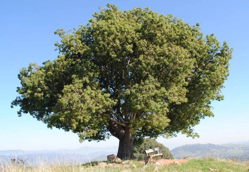
According to Phillip Green, ACT Electoral Commissioner, Kurrajong is the only electorate not named after an Aboriginal name for a geographical feature. "The original names for most of the electorate's most prominent natural features including Black Mountain, Mount Ainslie and Mount Majura have sadly been lost," explains Green, adding "instead we settled on Kurrajong, not only because of the tree, but also because it's the name of the early settlers of the district used for Capital Hill."
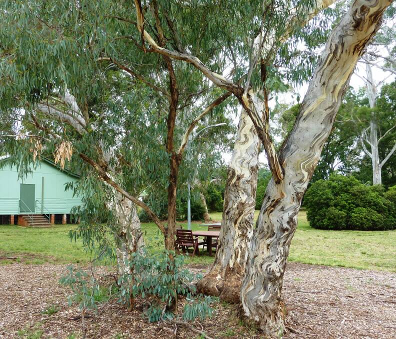
Timeless treasure: Corroboree Park, Ainslie. This now popular suburban park was once a focal point for the local indigenous community and was also reputedly an intrinsic part of the European settlement of the region with claims pastoralist James Ainslie camped here in 1825. Near the park's hall is an ancient Yellow Box (Eucalyptus melliodora) growing as four secondary stems around a rotted-out main trunk, which according to the nearby sign, "would have already been hundreds of years old when Captain Cook sailed up the east coast."
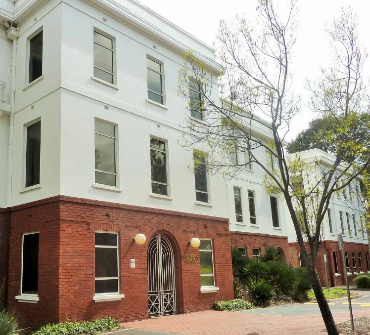
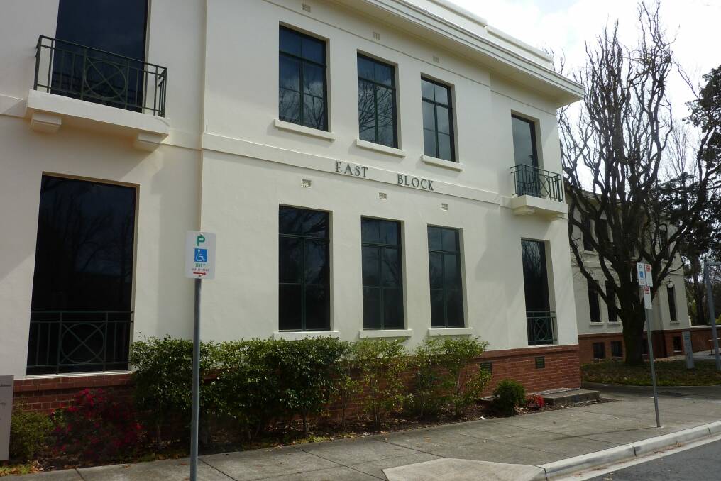
It was the first time I'd heard the theory and subsequent snooping around the Parliamentary Triangle reveals that there may be some substance to this claim. Check-out the photos of each building which, according to the theory suggest that the West Block foundations must be a metre or so lower than those of East Block. Are there any surveyors who can confirm this design quirk?
Natural Wonder: It's hard to go past the native trees after which this electorate is called. Kurrajongs, which are relatively slow growing and their trunk acts as a water storage device that allows them to survive dry conditions, have a small bell-shaped speckled cream flower from October to March.
Aboriginal people had many uses for the tree and post European settlement they have also been planted as fodder for stock during times of drought. There are many Kurrajongs scattered throughout the suburbs, including atop Mount Majura (8000 were planted there in as part of a fodder-tree reserve back in 1920!), a stand at Westbourne Woods and almost two-hundred planted along Limestone Avenue in Braddon, Reid and Ainslie. I'm not sure if there are any left on Capital Hill, but would be happy to be advised otherwise.
Curious creature: This column was buoyed by the recent news that 'Rosie' and 'Rex', a pair of Rosenberg's Monitors (Varanus rosenbergi) living in the bush of Mt Ainslie are now the proud parents of several hatchlings. According to Matthew Higgins, Ainslie resident, who has been keeping a close eye on the "egg stash" for several months, "unlike Lace Monitors where the mother returns to dig out the hatchlings young Rosenberg's dig their own way out."
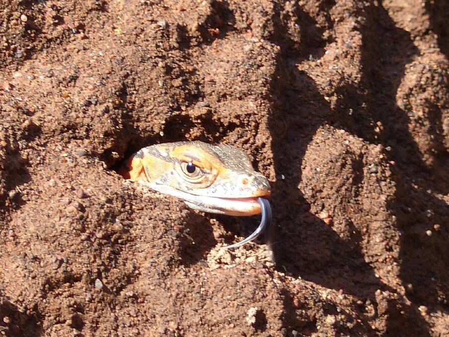
"This hatchling appeared several times at the hole, flicking its tongue as it sensed the air," reveals Higgins, pointing out, "it was a wonderful moment, representing another generation of a rare ACT species, officially listed as threatened throughout most of its range in Australia, going forth into the great Australian bush."
Don't miss: The 45th Spring Wildflower Ramble at Black Mountain. Established by celebrated conservationist the late Dr Nancy Burbidge, and continued by enthusiastic ecologist, George Chippendale, discover the surprising diversity of tiny orchids, bush peas, wattles and billy buttons which grow on Black Mountain. All welcome. Saturday, October 8, 2016, from 9.30am to noon. Meet at the Belconnen Way entry gate to Black Mountain Nature Reserve, before Caswell Drive turnoff – look for balloons. Gold coin donation to Friends of Black Mountain.
Spotlight on Brindabella
Brindabella is a five member electorate comprising the district of Tuggeranong (excluding the suburb of Kambah and that portion of Tuggeranong District adjacent to Kambah to the west of Athllon Drive), and the districts of Booth, Cotter River, Paddy's River, Rendezvous Creek, Tennent and Mount Clear.
Did You Know? The name 'Brindabella' is derived from an Aboriginal word meaning 'two kangaroo rats'. For generations of Canberrans, Brindabella is the name associated with the mountain range which dominates the south-western horizon of our city.
Timeless Treasure: For thousands of years Aboriginal people travelled through the Tuggeranong valley to feast upon bogong moths aestivating high on the Brindabellas. Many cultural artefacts and camp sites have been (re)discovered in and around the valley including tools, scared trees, ceremonial stone arrangements and axe grinding grooves. Featuring around twenty grooves in a small sandstone outcrop, a little-known site in Theodore is one of the most accessible of these. The grooves aren't signposted and although they are easier to see after rain (as water pools in the grooves) are relatively easy to find. Park on Christmas Street near the Tuggeranong Hill Nature Park sign and walk 150 metres or so uphill towards the two oldest (and biggest) gum trees.

Local secret: During the Second World War, part of what is now suburban Tuggeranong was used by three Royal Australian Air Force squadrons for bombing practice using chalk dust bombs in metal casings. According to an ACT Heritage 'Canberra Tracks' sign at the site in Stranger Hill Reserve in Bonython, local farmer Merv Edlington had to duck one day when a plane came so low that he got covered with leaves off the tree he was under.
"The wing of the plane chopped them off. The horse I'd been riding took off and took a week to catch!" recalls Edlington. Thankfully, the reserve, which you can enter from near 41 Ebenezer Street, is a much safer place to visit these days.
Natural Wonder: Hidden in bushland near the Cotter Reserve are the Cotter Caves, which due to the threat of vandalism and safety concerns have been off limits to the public since the mid-1950s.
Despite this lengthy closure, trespassers have still infiltrated the 80-metre deep abyss, spray-painting unintelligent mono-syllabic musings on its walls and snapping-off almost all of the cave's stalactites and stalagmites.
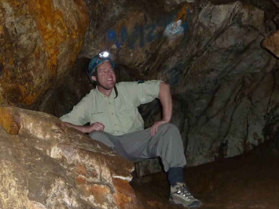
"Thankfully there is evidence of formations slowly starting to re-form – but they will take hundreds of thousands of years," laments John Brush, an experienced speleologist who mapped the caves in the 1975, and who several years ago joined this column on an approved expedition to highlight the reasons for being closed.
Apart from safety issues and the risk of further vandalism, the third reason the caves are off-limits to the public is to aid conservation of bent-winged bats. Plentiful in the cave mid last century, in recent decades they've all but disappeared and it is hoped that a lack of human disturbance in the caves and the bat-friendly (designed to allow the bats to fly both in and out of the cave) steel gate will encourage their return here.
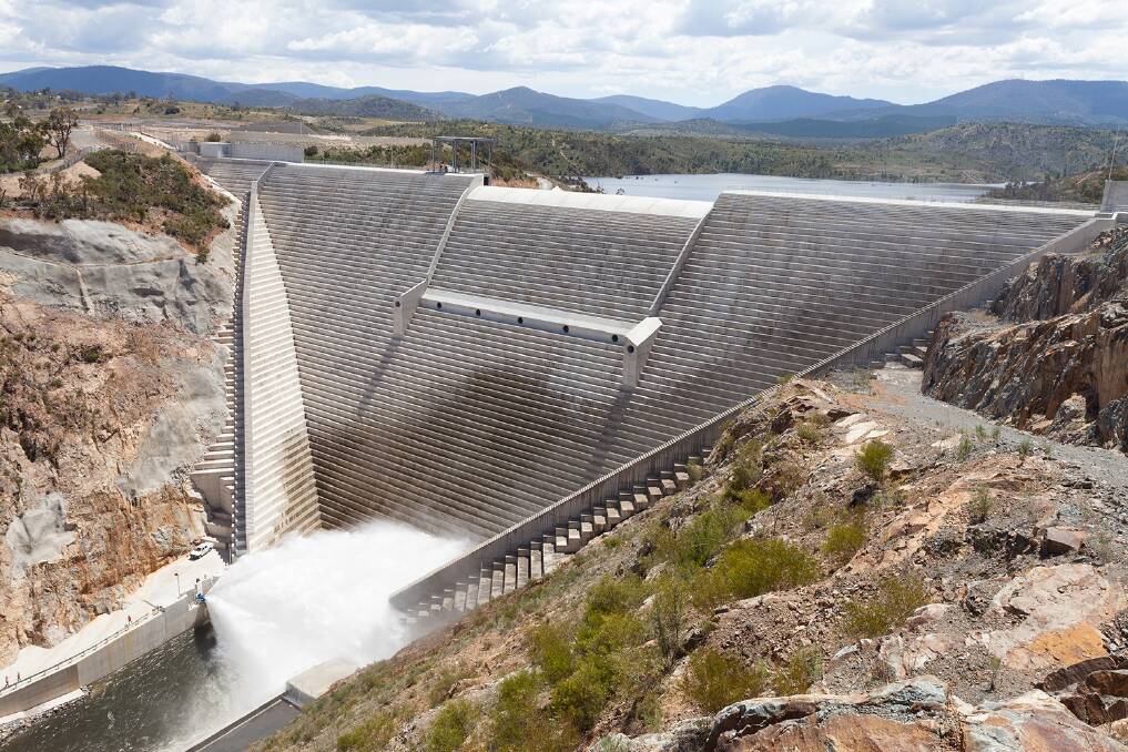
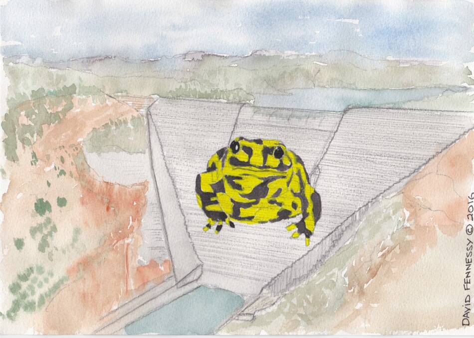
Curious creature: Unless you are an engineer, you probably agree that except for when they are in flood, large dam walls are ugly. Our new Cotter Dam, located on the edge of the Brindabella electorate, is no exception and in the spirit of an election campaign, this column has its own fanciful proposal to spruce it up. Imagine if the dam wall was adorned with images (painted or projected) of endangered creatures from the Cotter catchment. The otherwise bland wall could feature a giant Murray Cod or perhaps the critically endangered Northern Corroboree frog. Sure it would be a logistical challenge, but not only would it highlight the plight of these critters, but it would also become a unique tourist attraction. Ok, I did say it was fanciful. That said, giant murals have been created to great effect on dam walls elsewhere, including Poland's Solina Dam. Thanks to David Fennessy for the concept sketch.
Don't miss: Following a cold change, especially in winter and early spring, the gaze of many Canberrans turns to the snow-covered Brindabellas. Early last century there were bigger more frequent falls and in 1938, the Canberra Alpine Club built a ski chalet at Mt Franklin. Sadly it was razed in the 2003 bushfires, but on Sunday 16 October (from 10am-noon) the club will host an open day at the site. On display will be a collection of heritage skis and other skiing equipment (much of it hand crafted) and early snow and ski recreational memorabilia. Free entry, Ph: 6207 2900 for directions.
WHERE IN CANBERRA?
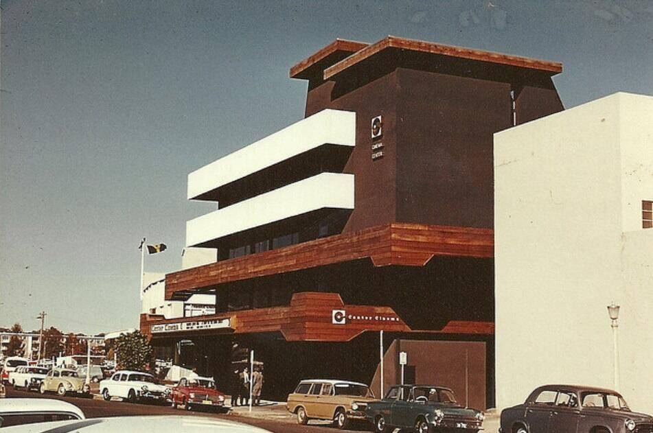
Cryptic Clue: In political lingo, neither left, nor right.
Degree of difficulty: Easy (about time many of your say!)

Last week: Congratulations to Leanne Gundry, of Watson, who was first to correctly identify last week's photo as the Palmer Trigonometrical Station in Amaroo, which was first erected in 1878 during a government survey of the area. The stone cairn, wooden pole and metal circular vanes is typical of early survey trigs which formed a network across NSW and were used by surveyors during the course of land grant surveys and mapping projects. Fearing it would be lost is time with the encroaching suburbs of Gungahlin, the trig was reconstructed by the Canberra Division of the Institution of Surveyors in 1996, and can be reached by walking about 100 metres past the metal archway near the intersection of Roderick St with Sandover Circuit.
How to enter: Email your guess along with your name and address to timtheyowieman@bigpond.com. The first email sent after 10am, Saturday October 8, 2016 with the correct answer wins a double pass to Dendy cinemas.
CONTACT TIM: Email: timtheyowieman@bigpond.com or Twitter: @TimYowie or write c/- The Canberra Times, 9 Pirie Street, Fyshwick. You can see a selection of past columns here.

